Bury St Edmunds houses [165]
Introduction
The photograph on this page of Bury St Edmunds houses [165] by Michael Dibb as part of the Geograph project.
The Geograph project started in 2005 with the aim of publishing, organising and preserving representative images for every square kilometre of Great Britain, Ireland and the Isle of Man.

There are currently over 7.5m images from over 14,400 individuals and you can help contribute to the project by visiting https://www.geograph.org.uk
Bury St Edmunds houses [165]
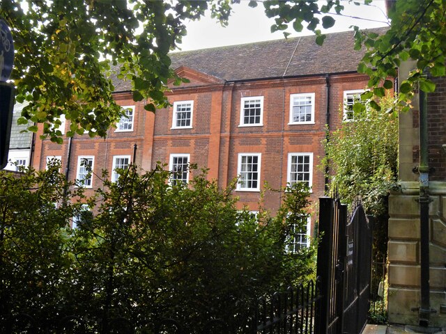
Image: © Michael Dibb Taken: 11 Sep 2020
Glimpsed from alongside the Old Shire Hall is St Margarets House. Built, in red brick with lighter rubbed brick dressings, in the early 18th century and altered and extended in the early 20th century. The house incorporporates part of the Abbey's precinct wall. Some 17th and 18th century internal features remain. The house was used as offices of West Suffolk County Council from 1932 until it was sold and re-converted to private residential accommodation circa 2013. Listed, grade II*, with details at: https://historicengland.org.uk/listing/the-list/list-entry/1375562 Honey Hill, with its wealth of history used to finish at Sparhawk Street from thereon it was known as Schoolhall Street when the Abbey’s song school was here. The Abbey’s St Margarets Gate was taken down to allow free passage into The Great Churchyard. Bury St Edmunds is a market town which is the cultural and retail centre for West Suffolk and is known for brewing (Greene King) and sugar (British Sugar). There is scattered evidence of earlier activity but essentially Bury St Edmunds began as one of the royal boroughs of the Saxons and a monastery was founded which became the burial place of King Edmund. A new Benedictine abbey was built in 1020 which became rich and powerful and the town was laid out on a grid pattern by Abbot Baldwin. After the dissolution the abbey became ruinous. A new church, later the cathedral, was begun in the early 16th century.
Images are licensed for reuse under creativecommons.org/licenses/by-sa/2.0
Image Location
Latitude
52.242637
Longitude
0.719952