Line of buildings at Sandaig
Introduction
The photograph on this page of Line of buildings at Sandaig by Des Blenkinsopp as part of the Geograph project.
The Geograph project started in 2005 with the aim of publishing, organising and preserving representative images for every square kilometre of Great Britain, Ireland and the Isle of Man.

There are currently over 7.5m images from over 14,400 individuals and you can help contribute to the project by visiting https://www.geograph.org.uk
Line of buildings at Sandaig
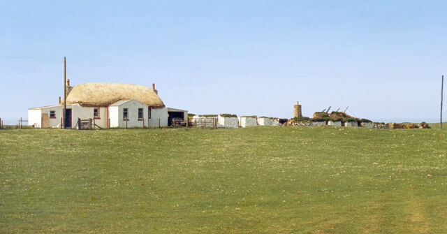
Image: © Des Blenkinsopp Taken: Unknown
I am reasonably sure that I have got this right, but it was a long time ago that I was here and what has happened since then appears a bit confusing. There is little on the web about it, but from looking at other Geographs it would seem that these buildings were restored at one time and then allowed to go derelict again. If I have made a mistake then let me know and I'll correct it. From a print, date not exact.
Images are licensed for reuse under creativecommons.org/licenses/by-sa/2.0
Image Location


Leaflet Map data © OpenStreetMap
Latitude
56.481162
Longitude
-6.971684