W W II Pillbox, Near M53
Introduction
The photograph on this page of W W II Pillbox, Near M53 by BrianPritchard as part of the Geograph project.
The Geograph project started in 2005 with the aim of publishing, organising and preserving representative images for every square kilometre of Great Britain, Ireland and the Isle of Man.

There are currently over 7.5m images from over 14,400 individuals and you can help contribute to the project by visiting https://www.geograph.org.uk
W W II Pillbox, Near M53
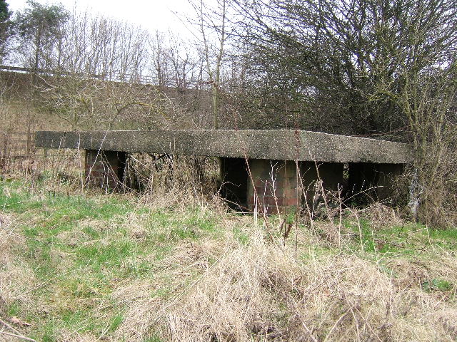
Image: © BrianPritchard Taken: 25 Jan 2008
This is a WWII Type FW3/26 Pillbox, located next to the M53. It is a square pillbox with a 6in. concrete roof supported on corner brick pillars, with internal anti ricochet walls and simple entranceway [steps down into pillbox]. Faces north-east, traces of dark green camouflage paint on pillars, built 1940/41.
Images are licensed for reuse under creativecommons.org/licenses/by-sa/2.0
Image Location
Latitude
53.213971
Longitude
-2.858608