Signpost near Blagdon Terrace, Seaton Burn
Introduction
The photograph on this page of Signpost near Blagdon Terrace, Seaton Burn by Geoff Holland as part of the Geograph project.
The Geograph project started in 2005 with the aim of publishing, organising and preserving representative images for every square kilometre of Great Britain, Ireland and the Isle of Man.

There are currently over 7.5m images from over 14,400 individuals and you can help contribute to the project by visiting https://www.geograph.org.uk
Signpost near Blagdon Terrace, Seaton Burn
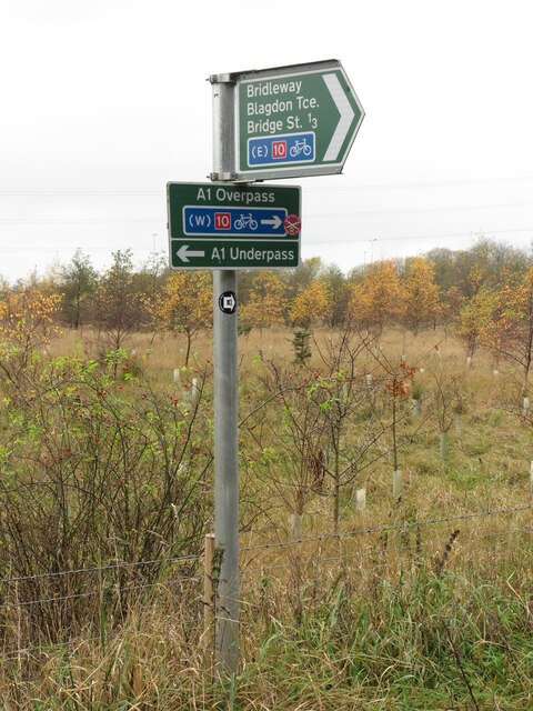
Image: © Geoff Holland Taken: 10 Nov 2020
This multi-directional signpost lies on the route of the Reivers Way (National Cycle Route 10), a brace of waymarked bi-directional coast to coast cycle routes between the North and Irish Seas. There are two types of routes, an off-road route and an on-road route, with the off-road one being waymarked with dark red coloured waymarkers, as seen here. This is also the route of the 'Tyne & Wear Heritage Way' (black & white disc), an 80 mile route taking in the rich historic and industrial heritage of the area. The way is broken down into nine convenient sections that can be walked at any time, and in any order.
Images are licensed for reuse under creativecommons.org/licenses/by-sa/2.0
Image Location
Latitude
55.058127
Longitude
-1.631767