A Pre-fab
Introduction
The photograph on this page of A Pre-fab by Anne Burgess as part of the Geograph project.
The Geograph project started in 2005 with the aim of publishing, organising and preserving representative images for every square kilometre of Great Britain, Ireland and the Isle of Man.

There are currently over 7.5m images from over 14,400 individuals and you can help contribute to the project by visiting https://www.geograph.org.uk
A Pre-fab
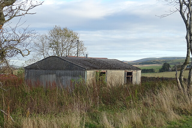
Image: © Anne Burgess Taken: 5 Nov 2020
As we got close to Cairndard, I realised that the building looked very familiar. It's a pre-fab, short for prefabricated house. After the second world war there was a huge shortage of housing, and large numbers of prefabricated houses like these were quickly erected as a temporary solution to the housing shortage. I knew the type well because as a child I often visited one of my school friends who lived in a pre-fab just round the corner from my home. It was a bit surprising to find a single one out here well away from any other houses, and it would be interesting to know when it was erected here and why. Compare this with Image and Image and see https://www.prefabmuseum.uk/content/history/one-arcon-story
Images are licensed for reuse under creativecommons.org/licenses/by-sa/2.0
Image Location
Latitude
57.315773
Longitude
-2.819131