Upton with Fishley village sign
Introduction
The photograph on this page of Upton with Fishley village sign by Adrian S Pye as part of the Geograph project.
The Geograph project started in 2005 with the aim of publishing, organising and preserving representative images for every square kilometre of Great Britain, Ireland and the Isle of Man.

There are currently over 7.5m images from over 14,400 individuals and you can help contribute to the project by visiting https://www.geograph.org.uk
Upton with Fishley village sign
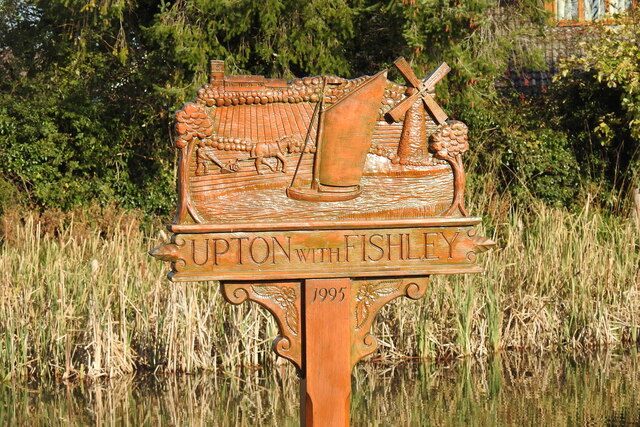
Image: © Adrian S Pye Taken: 7 Nov 2020
The sign is planted in the village pond. I’m sure they had their reasons which are perfectly valid. Almost looking as if it’s made from gingerbread it is extremely detailed. We see Upton church behind a stone wall, ploughed fields, more stone wall, and a ploughman going over what he’s already ploughed a second time. Upton drainage mill and a representation of a Norfolk Wherry on the River Bure. It is dated 1995 https://www.geograph.org.uk/photo/6668092.
Images are licensed for reuse under creativecommons.org/licenses/by-sa/2.0
Image Location
Latitude
52.657572
Longitude
1.542366