Fosse Lodge
Introduction
The photograph on this page of Fosse Lodge by Vieve Forward as part of the Geograph project.
The Geograph project started in 2005 with the aim of publishing, organising and preserving representative images for every square kilometre of Great Britain, Ireland and the Isle of Man.

There are currently over 7.5m images from over 14,400 individuals and you can help contribute to the project by visiting https://www.geograph.org.uk
Fosse Lodge
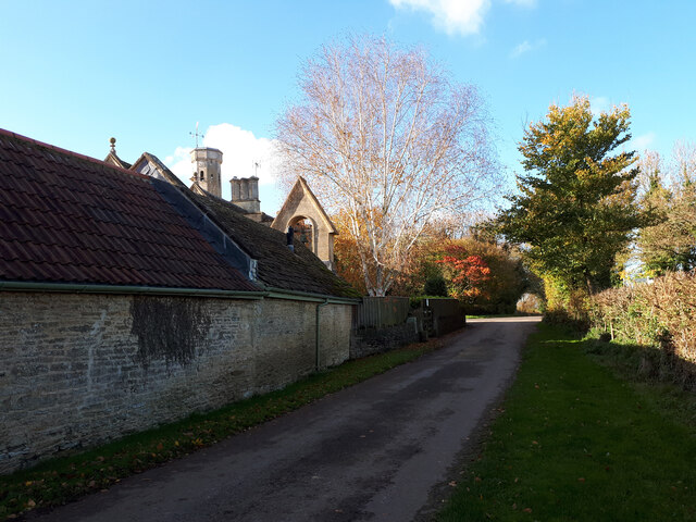
Image: © Vieve Forward Taken: 4 Nov 2020
Grade II listed former gamekeeper's lodge of the Grittleton Estate, built in 1835. The tower is said to have been an observation tower. The belfry was added to an outhouse later (the stonework appears to be modern), probably in reference to a chapel, the site of which lies just beyond the crossroads to the left. https://historicengland.org.uk/listing/the-list/list-entry/1198366
Images are licensed for reuse under creativecommons.org/licenses/by-sa/2.0
Image Location


Leaflet Map data © OpenStreetMap
Latitude
51.537079
Longitude
-2.207136