Bury St Edmunds houses [88]
Introduction
The photograph on this page of Bury St Edmunds houses [88] by Michael Dibb as part of the Geograph project.
The Geograph project started in 2005 with the aim of publishing, organising and preserving representative images for every square kilometre of Great Britain, Ireland and the Isle of Man.

There are currently over 7.5m images from over 14,400 individuals and you can help contribute to the project by visiting https://www.geograph.org.uk
Bury St Edmunds houses [88]
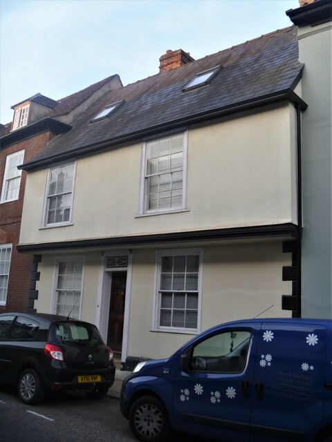
Image: © Michael Dibb Taken: 13 Sep 2020
Number 75 Guildhall Street is 16th century, refronted in 1772, timber framed, jettied along the street and stuccoed. There are two 18th century rear extensions. Some 18th and 19th century internal features remain. Listed, grade II, with details at: https://historicengland.org.uk/listing/the-list/list-entry/1363711 Guildhall Street is one of the north-south streets laid out in the 12th century. There is a rich mix of high quality buildings, especially at the commercial, northern end with a fine mix of houses at the residential, southern end. The Guildhall is a Norman building which is the oldest continuously used Civic building in the country. Bury St Edmunds is a market town which is the cultural and retail centre for West Suffolk and is known for brewing (Greene King) and sugar (British Sugar). There is scattered evidence of earlier activity but essentially Bury St Edmunds began as one of the royal boroughs of the Saxons and a monastery was founded which became the burial place of King Edmund. A new Benedictine abbey was built in 1020 which became rich and powerful and the town was laid out on a grid pattern by Abbot Baldwin. After the dissolution the abbey became ruinous. A new church, later the cathedral, was begun in the early 16th century.
Images are licensed for reuse under creativecommons.org/licenses/by-sa/2.0
Image Location
Latitude
52.242912
Longitude
0.711912