The Ship Inn, Main Street, Greenodd
Introduction
The photograph on this page of The Ship Inn, Main Street, Greenodd by Stephen Craven as part of the Geograph project.
The Geograph project started in 2005 with the aim of publishing, organising and preserving representative images for every square kilometre of Great Britain, Ireland and the Isle of Man.

There are currently over 7.5m images from over 14,400 individuals and you can help contribute to the project by visiting https://www.geograph.org.uk
The Ship Inn, Main Street, Greenodd
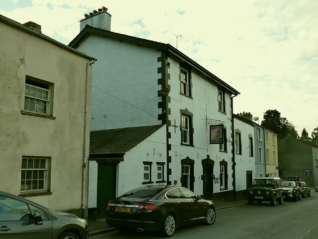
Image: © Stephen Craven Taken: 11 Oct 2020
According to a local shopkeeper, the Ship closed with the Covid-19 lockdown of March 2020 and as of October had not yet reopened, although there were signs of decorators having been at work inside. The two houses beyond the pub in this photo are the only listed buildings in the village (grade II, list entry 1154862). The 1913 map labels one or both of these as PO (post office?).
Images are licensed for reuse under creativecommons.org/licenses/by-sa/2.0
Image Location
Latitude
54.233411
Longitude
-3.053767