4 Vicar Lane, Chester
Introduction
The photograph on this page of 4 Vicar Lane, Chester by Stephen Richards as part of the Geograph project.
The Geograph project started in 2005 with the aim of publishing, organising and preserving representative images for every square kilometre of Great Britain, Ireland and the Isle of Man.

There are currently over 7.5m images from over 14,400 individuals and you can help contribute to the project by visiting https://www.geograph.org.uk
4 Vicar Lane, Chester
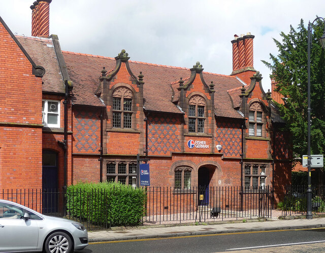
Image: © Stephen Richards Taken: 18 Aug 2014
Recognisably touched by the hand of John Douglas. Built in 1889-90 as the House of Shelter, almshouses. Ruabon brick with blue brick diapering, elaborate dormers and chimneystacks. Grade II listed. Now offices of surveyors Fisher German.
Images are licensed for reuse under creativecommons.org/licenses/by-sa/2.0
Image Location
Latitude
53.189681
Longitude
-2.885811