All Saints Snodland with Christ Church Lower Birling
Introduction
The photograph on this page of All Saints Snodland with Christ Church Lower Birling by Richard Dorrell as part of the Geograph project.
The Geograph project started in 2005 with the aim of publishing, organising and preserving representative images for every square kilometre of Great Britain, Ireland and the Isle of Man.

There are currently over 7.5m images from over 14,400 individuals and you can help contribute to the project by visiting https://www.geograph.org.uk
All Saints Snodland with Christ Church Lower Birling
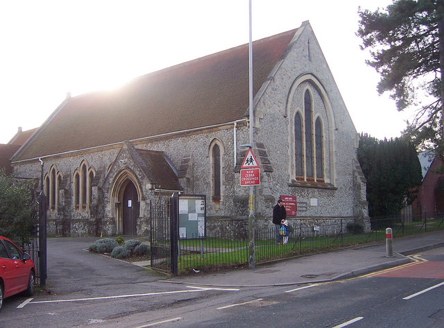
Image: © Richard Dorrell Taken: 22 Jan 2008
This small church stands on the Malling Road, at the southern end of the "old" part of Snodland. I am grateful to the current rector of the church who contacted me with the following information regarding the name of the church: Christ Church is in the town of Snodland, but its official ecclesiastical title is Christ Church, Lower Birling. It needs to be distinguished from a different (much older) church called All Saints, Snodland. Originally the churches were located in two separate parishes of Snodland and Lower Birling.
Images are licensed for reuse under creativecommons.org/licenses/by-sa/2.0
Image Location
Latitude
51.324363
Longitude
0.440608