Street and Glastonbury Tor from Walton Hill
Introduction
The photograph on this page of Street and Glastonbury Tor from Walton Hill by Edwin Graham as part of the Geograph project.
The Geograph project started in 2005 with the aim of publishing, organising and preserving representative images for every square kilometre of Great Britain, Ireland and the Isle of Man.

There are currently over 7.5m images from over 14,400 individuals and you can help contribute to the project by visiting https://www.geograph.org.uk
Street and Glastonbury Tor from Walton Hill
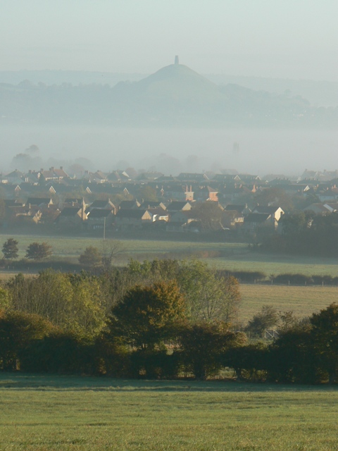
Image: © Edwin Graham Taken: 2 Nov 2007
The small town of Street prefers to be regarded as a village, though the modern shopping complex of Clarks Village near the main street suggests otherwise. Street lies between Walton Hill (an outpost of the Polden Hills) and Glastonbury Tor, some four or five miles away. Beyond the Tor on this cold and misty morning, the Mendip Hills can just be made out.
Images are licensed for reuse under creativecommons.org/licenses/by-sa/2.0
Image Location
Latitude
51.114531
Longitude
-2.757968