Old Wayside Cross
Introduction
The photograph on this page of Old Wayside Cross by L Nott as part of the Geograph project.
The Geograph project started in 2005 with the aim of publishing, organising and preserving representative images for every square kilometre of Great Britain, Ireland and the Isle of Man.

There are currently over 7.5m images from over 14,400 individuals and you can help contribute to the project by visiting https://www.geograph.org.uk
Old Wayside Cross
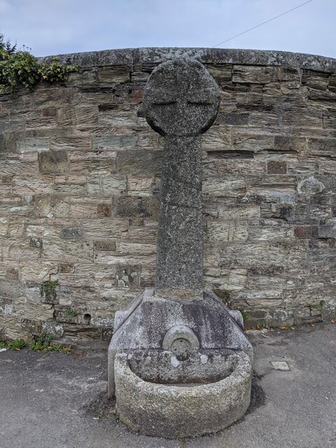
Image: © L Nott Taken: 19 Oct 2020
Berrycoombe Cross, a Wayside Cross with an old head and shaft. Set against the east end of the outer wall of Old Bodmin Jail at the junction of Berrycoombe Road and Scarletts Well Road in Bodmin parish. Grade II Listed https://historicengland.org.uk/listing/the-list/list-entry/1280333. See also http://www.flickr.com/photos/ocifant/2879453049 and https://www.geograph.org.uk/photo/5203876 Milestone Society National ID: CWNC_BOD04
Images are licensed for reuse under creativecommons.org/licenses/by-sa/2.0
Image Location


Leaflet Map data © OpenStreetMap
Latitude
50.474585
Longitude
-4.726858