Old Boundary Marker
Introduction
The photograph on this page of Old Boundary Marker by Mike Rayner as part of the Geograph project.
The Geograph project started in 2005 with the aim of publishing, organising and preserving representative images for every square kilometre of Great Britain, Ireland and the Isle of Man.

There are currently over 7.5m images from over 14,400 individuals and you can help contribute to the project by visiting https://www.geograph.org.uk
Old Boundary Marker
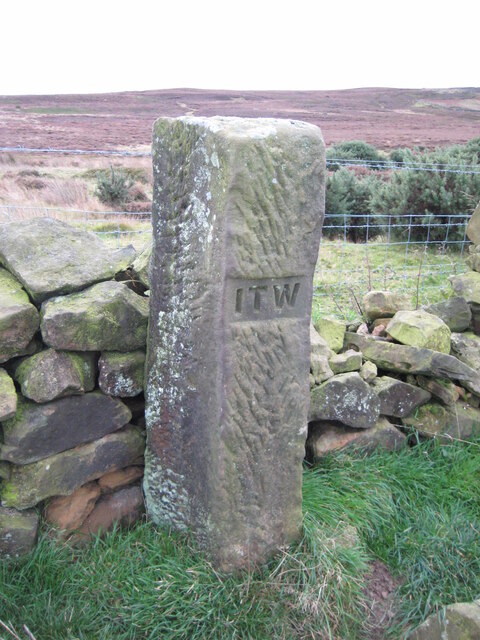
Image: © Mike Rayner Taken: 22 Oct 2020
Estate Boundary Marker on the northwest side of the intake wall 390 metres east of Aysdale Gate Farm in Lockwood parish. Inscribed I T W. On the boundary of the Skelton and Guisborough estates. Milestone Society National ID: YN_LOCK24em
Images are licensed for reuse under creativecommons.org/licenses/by-sa/2.0
Image Location


Leaflet Map data © OpenStreetMap
Latitude
54.523704
Longitude
-0.989274