Widdington: plaster and thatch
Introduction
The photograph on this page of Widdington: plaster and thatch by John Sutton as part of the Geograph project.
The Geograph project started in 2005 with the aim of publishing, organising and preserving representative images for every square kilometre of Great Britain, Ireland and the Isle of Man.

There are currently over 7.5m images from over 14,400 individuals and you can help contribute to the project by visiting https://www.geograph.org.uk
Widdington: plaster and thatch
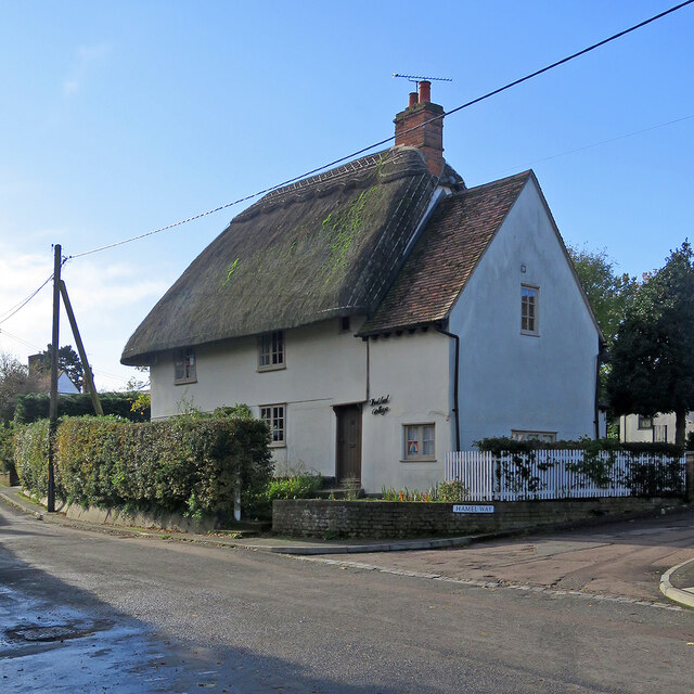
Image: © John Sutton Taken: 25 Oct 2020
This 17th-century timber-framed house on the corner of Hamel Way is Grade II listed.
Images are licensed for reuse under creativecommons.org/licenses/by-sa/2.0
Image Location
Latitude
51.960981
Longitude
0.237193