Benchmarks on house at junction of A6071 and Station Road
Introduction
The photograph on this page of Benchmarks on house at junction of A6071 and Station Road by Roger Templeman as part of the Geograph project.
The Geograph project started in 2005 with the aim of publishing, organising and preserving representative images for every square kilometre of Great Britain, Ireland and the Isle of Man.

There are currently over 7.5m images from over 14,400 individuals and you can help contribute to the project by visiting https://www.geograph.org.uk
Benchmarks on house at junction of A6071 and Station Road
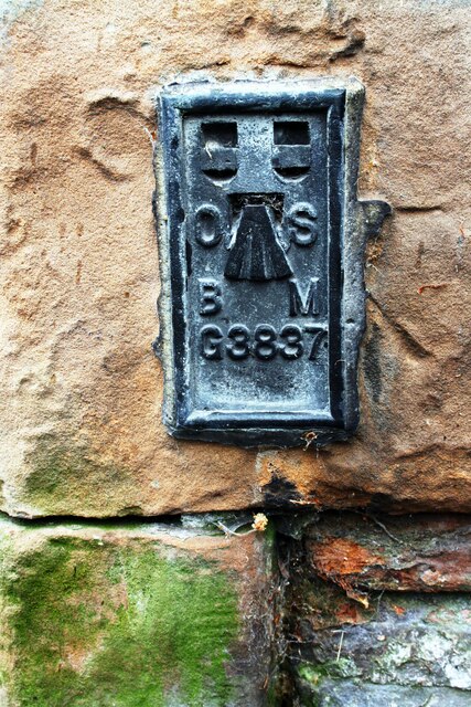
Image: © Roger Templeman Taken: 31 May 2019
Ordnance Survey flush bracket (identifier G3837) benchmark installed over an earlier cut mark. The flush bracket was installed in 1955 and verified in 1972, levelled at 81.561m above Newlyn Datum. The cut mark was cut in 1844 and levelled at 267.371ft above Liverpool Datum
Images are licensed for reuse under creativecommons.org/licenses/by-sa/2.0
Image Location
Latitude
54.942919
Longitude
-2.727717