The Windmill, Terling
Introduction
The photograph on this page of The Windmill, Terling by Tim Heaton as part of the Geograph project.
The Geograph project started in 2005 with the aim of publishing, organising and preserving representative images for every square kilometre of Great Britain, Ireland and the Isle of Man.

There are currently over 7.5m images from over 14,400 individuals and you can help contribute to the project by visiting https://www.geograph.org.uk
The Windmill, Terling
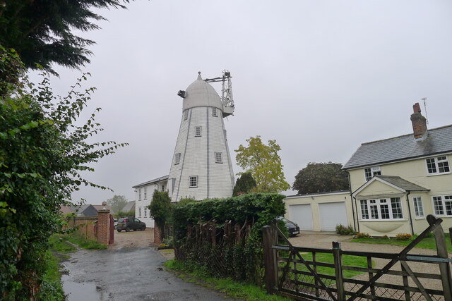
Image: © Tim Heaton Taken: 13 Oct 2020
"Smock mill, now a dwelling, and attached house. Early C19, ..." https://historicengland.org.uk/listing/the-list/list-entry/1123419
Images are licensed for reuse under creativecommons.org/licenses/by-sa/2.0
Image Location
Latitude
51.805709
Longitude
0.55763