Bury, The Parish Church of Saint Thomas
Introduction
The photograph on this page of Bury, The Parish Church of Saint Thomas by David Dixon as part of the Geograph project.
The Geograph project started in 2005 with the aim of publishing, organising and preserving representative images for every square kilometre of Great Britain, Ireland and the Isle of Man.

There are currently over 7.5m images from over 14,400 individuals and you can help contribute to the project by visiting https://www.geograph.org.uk
Bury, The Parish Church of Saint Thomas
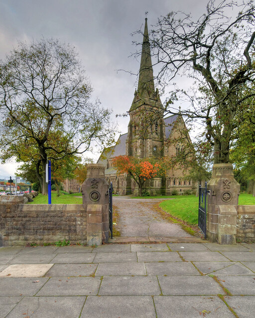
Image: © David Dixon Taken: 17 Oct 2020
Built in 1866 in early-English style, the Parish Church of St Thomas is at the corner of Pimhole Road and Rochdale Road. The church spire rises to a height of 129 feet. The Church was declared a Grade II listed building in 1985 (https://historicengland.org.uk/listing/the-list/list-entry/1067250 Historic England List Entry Number: 1067250).
Images are licensed for reuse under creativecommons.org/licenses/by-sa/2.0
Image Location
Latitude
53.592454
Longitude
-2.282029