Old Boundary Marker
Introduction
The photograph on this page of Old Boundary Marker by R Hanns as part of the Geograph project.
The Geograph project started in 2005 with the aim of publishing, organising and preserving representative images for every square kilometre of Great Britain, Ireland and the Isle of Man.

There are currently over 7.5m images from over 14,400 individuals and you can help contribute to the project by visiting https://www.geograph.org.uk
Old Boundary Marker
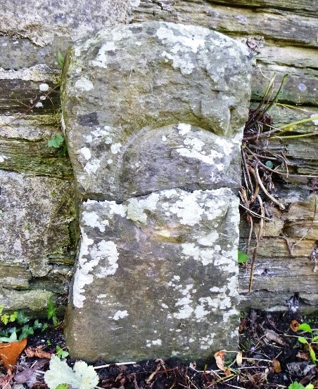
Image: © R Hanns Taken: 14 Sep 2019
County Bridge Marker on the east side of the B3254 100 metres northeast of Yeolm Bridge, River Ottery. Werrington parish, formerly Devon, now Cornwall. Inscribed C. The stone marks the extent of roadway adjoining the bridge that the County was obliged to maintain. Grade II Listed details https://historicengland.org.uk/listing/the-list/list-entry/1328068. Milestone Society National ID: CW_WERR02br
Images are licensed for reuse under creativecommons.org/licenses/by-sa/2.0
Image Location
Latitude
50.662253
Longitude
-4.380675