Footpath passing under Ashurst station
Introduction
The photograph on this page of Footpath passing under Ashurst station by Marathon as part of the Geograph project.
The Geograph project started in 2005 with the aim of publishing, organising and preserving representative images for every square kilometre of Great Britain, Ireland and the Isle of Man.

There are currently over 7.5m images from over 14,400 individuals and you can help contribute to the project by visiting https://www.geograph.org.uk
Footpath passing under Ashurst station
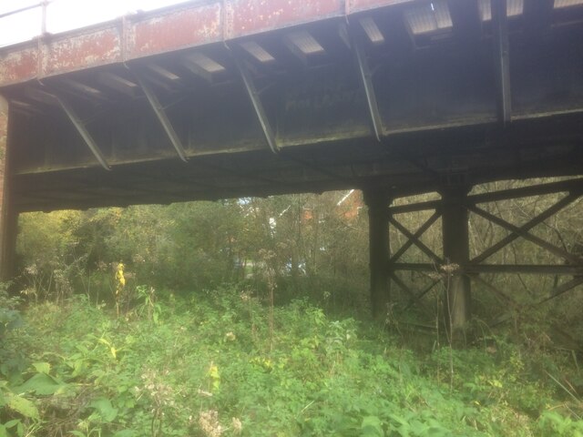
Image: © Marathon Taken: 18 Oct 2020
The London, Brighton & South Coast Railway opened the railway between Hurst Green and Eridge on 2nd January 1888. Ashurst station was opened on 1st October of that year. The station was destaffed around 1970, following which all the station buildings were demolished in 1983. It is now on the Uckfield to Oxted line and is one of the few non-electrified railways in South East England. A footpath which follows the west side of the River Medway passes over the river near a weir and then passes under Ashurst station as seen here. For a view of the station see https://www.geograph.org.uk/photo/3021829
Images are licensed for reuse under creativecommons.org/licenses/by-sa/2.0
Image Location
Latitude
51.12965
Longitude
0.152184