Old Boundary Marker
Introduction
The photograph on this page of Old Boundary Marker by R Hanns as part of the Geograph project.
The Geograph project started in 2005 with the aim of publishing, organising and preserving representative images for every square kilometre of Great Britain, Ireland and the Isle of Man.

There are currently over 7.5m images from over 14,400 individuals and you can help contribute to the project by visiting https://www.geograph.org.uk
Old Boundary Marker
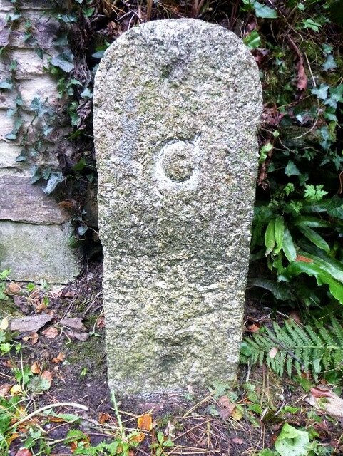
Image: © R Hanns Taken: 5 Oct 2019
County Bridge Marker on the southeast side of the lane that runs parallel to and north of the River Lerryn in Lerryn village. St Winnow parish. Inscribed C. The stone marks the extent of roadway adjoining the bridge that the County was obliged to maintain. Milestone Society National ID: CW_WINNOW01br
Images are licensed for reuse under creativecommons.org/licenses/by-sa/2.0
Image Location
Latitude
50.384764
Longitude
-4.617509