Leybourne Grange - clocktower
Introduction
The photograph on this page of Leybourne Grange - clocktower by Richard Dorrell as part of the Geograph project.
The Geograph project started in 2005 with the aim of publishing, organising and preserving representative images for every square kilometre of Great Britain, Ireland and the Isle of Man.

There are currently over 7.5m images from over 14,400 individuals and you can help contribute to the project by visiting https://www.geograph.org.uk
Leybourne Grange - clocktower
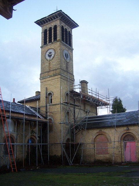
Image: © Richard Dorrell Taken: 21 Jan 2008
This tower is visible (as a glimpse) from the M20 motorway, but please don't be looking for it while you are driving! The tower, the stables around it, and Leybourne Grange itself are currently being restored to become the centrepiece in a new development of some 700 homes on the site of the former Leybourne Grange Hospital.
Images are licensed for reuse under creativecommons.org/licenses/by-sa/2.0
Image Location
Latitude
51.308695
Longitude
0.406774