Kenilworth houses [13]
Introduction
The photograph on this page of Kenilworth houses [13] by Michael Dibb as part of the Geograph project.
The Geograph project started in 2005 with the aim of publishing, organising and preserving representative images for every square kilometre of Great Britain, Ireland and the Isle of Man.

There are currently over 7.5m images from over 14,400 individuals and you can help contribute to the project by visiting https://www.geograph.org.uk
Kenilworth houses [13]
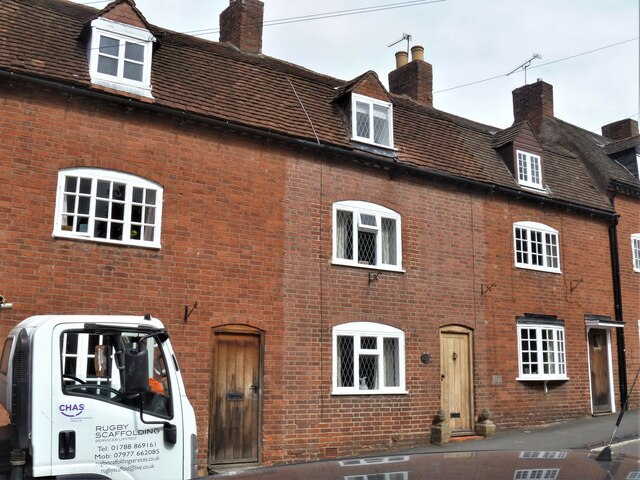
Image: © Michael Dibb Taken: 6 Aug 2020
Numbers 16, 18 and 20 Castle Hill are 18th century in red brick. Number 16 has a 20th century oriel window. The glazing bars at numbers 16 and 20 make the windows much more attractive than those of number 18. Listed, grade II, with details at: https://historicengland.org.uk/listing/the-list/list-entry/1364879 Kenilworth is a market town some 6 miles south west of Coventry. The town lies on Finham Brook, a tributary of the River Sowe, which joins the River Avon about 2 miles to the north-east. A priory and a castle were built at the same time around 1122. A field in the town is named Parliament Field as Henry III held a Parliament there in August 1266 whilst his troops were besieging the castle. Kenilworth today is a dormitory town for commuters to Coventry, Birmingham and Leamington Spa.
Images are licensed for reuse under creativecommons.org/licenses/by-sa/2.0
Image Location
Latitude
52.349045
Longitude
-1.588899