Pit House farm
Introduction
The photograph on this page of Pit House farm by Robert Graham as part of the Geograph project.
The Geograph project started in 2005 with the aim of publishing, organising and preserving representative images for every square kilometre of Great Britain, Ireland and the Isle of Man.

There are currently over 7.5m images from over 14,400 individuals and you can help contribute to the project by visiting https://www.geograph.org.uk
Pit House farm
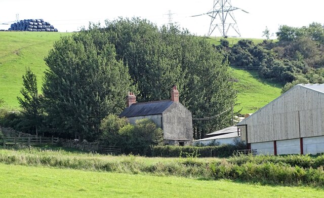
Image: © Robert Graham Taken: 14 Sep 2020
This little farm lies to the west of Iveston village. It's a bit of a mystery. On older O S maps (up to the 1940's) it is shown as Sunniside Pumping Station. Perhaps connected to mine workings. The sheds here are obviously 20th century, but the house looks older, and could date from the former use. The name Sunniside refers to the nearby large farmstead.
Images are licensed for reuse under creativecommons.org/licenses/by-sa/2.0
Image Location
Latitude
54.850259
Longitude
-1.771806