The Iron Bridge, Staines
Introduction
The photograph on this page of The Iron Bridge, Staines by Sean Davis as part of the Geograph project.
The Geograph project started in 2005 with the aim of publishing, organising and preserving representative images for every square kilometre of Great Britain, Ireland and the Isle of Man.

There are currently over 7.5m images from over 14,400 individuals and you can help contribute to the project by visiting https://www.geograph.org.uk
The Iron Bridge, Staines
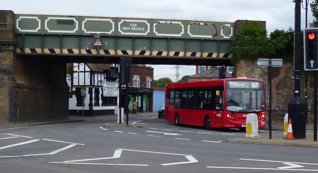
Image: © Sean Davis Taken: 24 Aug 2012
The original iron bridge erected here in 1844 was an arched cast-iron construction – the angled stone plates still form part of the walls under the bridge. The older bridge was replaced by “The Iron Bridge” in the early 20th century as double-decker buses could only get under the original bridge by driving in the middle of the road.
Images are licensed for reuse under creativecommons.org/licenses/by-sa/2.0
Image Location
Latitude
51.43499
Longitude
-0.508879