Barkisland Mills
Introduction
The photograph on this page of Barkisland Mills by Chris Allen as part of the Geograph project.
The Geograph project started in 2005 with the aim of publishing, organising and preserving representative images for every square kilometre of Great Britain, Ireland and the Isle of Man.

There are currently over 7.5m images from over 14,400 individuals and you can help contribute to the project by visiting https://www.geograph.org.uk
Barkisland Mills
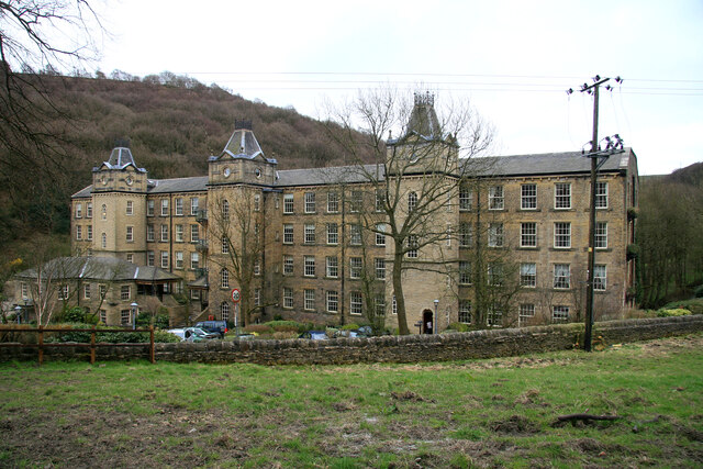
Image: © Chris Allen Taken: 4 Apr 2009
Giles and Goodall's Yorkshire Textile Mills lists this as Barkisland Mills while the map labels it as Barkisland Mill. Use of the plural for textile mills was common in Yorkshire and according to Holden reflected the rather piecemeal way that many sites developed. This fine building was at least in part water powered and the mill pond and water courses still survive. This elevation is rather fine and relatively unspoilt but the other side has some abominable excrescences resulting from its conversion to accommodation.
Images are licensed for reuse under creativecommons.org/licenses/by-sa/2.0
Image Location
Latitude
53.67409
Longitude
-1.901873