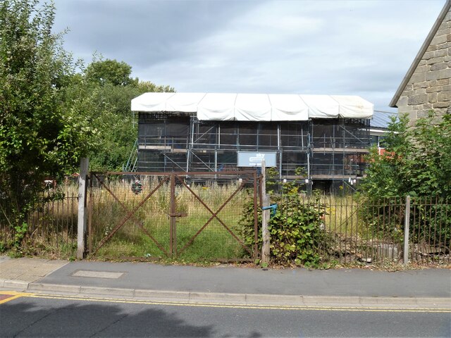
Warwick buildings [133]
Introduction
The photograph on this page of Warwick buildings [133] by Michael Dibb as part of the Geograph project.
The Geograph project started in 2005 with the aim of publishing, organising and preserving representative images for every square kilometre of Great Britain, Ireland and the Isle of Man.
There are currently over 7.5m images from over 14,400 individuals and you can help contribute to the project by visiting https://www.geograph.org.uk

Image: © Michael Dibb Taken: 4 Aug 2020
Hidden under the scaffolding and tarpaulins is The Masters House, a timber framed 15th century building part of the Leper Hospital of Saint Michael. The hospital was founded in the 12th century and this building was built on earlier foundations. The building was added to and converted into three cottages, 4, 5 and 6 St Michael's Place, in the 18th century. Neglected for decades the building was subject to an emergency rescue in 2018. This and the chapel Image form one of the very few leper hospitals of the early middle ages still surviving. The chapel is listed, grade II*, with details at: https://historicengland.org.uk/listing/the-list/list-entry/1035366 The site is a Scheduled Ancient Monument and details are at: https://historicengland.org.uk/listing/the-list/list-entry/1011035 A market town and county town of Warwickshire, Warwick lies on the River Avon, 11 miles (18 kilometres) south of Coventry. There is evidence of unbroken habitation from the 6th century AD with signs of Neolithic and Roman activity before that date. It was a Saxon burh in the 9th century and Warwick Castle was built during the Norman Conquest. Much of the town was destroyed in The Great Fire of Warwick in 1694. Warwick Racecourse is located just west of the town centre. The Grand Union Canal passes through the town and the restored Saltisford Canal Arm is close to the town centre.

