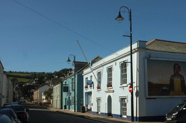
Victoria Road, Dartmouth
Introduction
The photograph on this page of Victoria Road, Dartmouth by Derek Harper as part of the Geograph project.
The Geograph project started in 2005 with the aim of publishing, organising and preserving representative images for every square kilometre of Great Britain, Ireland and the Isle of Man.
There are currently over 7.5m images from over 14,400 individuals and you can help contribute to the project by visiting https://www.geograph.org.uk

Image: © Derek Harper Taken: 27 Sep 2020
On the other side is the Conservative Club shown in http://www.geograph.org.uk/search.php?i=122371479 and described at https://historicengland.org.uk/listing/the-list/list-entry/1197589 : "one of a good group of houses and shops dating from the second quarter of the C19 alongside New Road (now Victoria Road) which was built in 1825 along the edge of the infilled mill pond to enable, for the first time, horse-drawn carriages in and out of the town." G=Beyond is the Seale Arms, succeeded by a listed house https://historicengland.org.uk/listing/the-list/list-entry/1218186 .

