The Ringing Stone
Introduction
The photograph on this page of The Ringing Stone by E MacPhillimy as part of the Geograph project.
The Geograph project started in 2005 with the aim of publishing, organising and preserving representative images for every square kilometre of Great Britain, Ireland and the Isle of Man.

There are currently over 7.5m images from over 14,400 individuals and you can help contribute to the project by visiting https://www.geograph.org.uk
The Ringing Stone
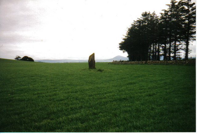
Image: © E MacPhillimy Taken: Unknown
http://www.rcahms.gov.uk/pls/portal/newcanmore.details_gis?inumlink=17644 "A standing stone having an appearance very like one of the flanking stones of a recumbent stone circle. It is 6 1/2 feet high, 2 1/2 feet broad and about a foot thick. On its E face is a single cup-mark, 2in diameter and 1/2in deep, 2 feet from the ground on the south edge. The W face has six cups, the largest two being 2in diameter and the others 1 1/2in diameter and 1/4in deep, one of which is only 6 inches from the ground. Additionally there are two doubtful cups about halfway up near the N edge of the stone. The tenants of Cotetown, in 1866, said that they remembered a cairn here, the stones of which were used to build Cotetown. The origin of the name was unknown but the stone was said to be haunted. J Ritchie 1918; Name Book 1866." and http://www.megalithic.co.uk/article.php?sid=17845
Images are licensed for reuse under creativecommons.org/licenses/by-sa/2.0
Image Location
Latitude
57.315231
Longitude
-2.700579