Bishopsbridge Road
Introduction
The photograph on this page of Bishopsbridge Road by Martin Addison as part of the Geograph project.
The Geograph project started in 2005 with the aim of publishing, organising and preserving representative images for every square kilometre of Great Britain, Ireland and the Isle of Man.

There are currently over 7.5m images from over 14,400 individuals and you can help contribute to the project by visiting https://www.geograph.org.uk
Bishopsbridge Road
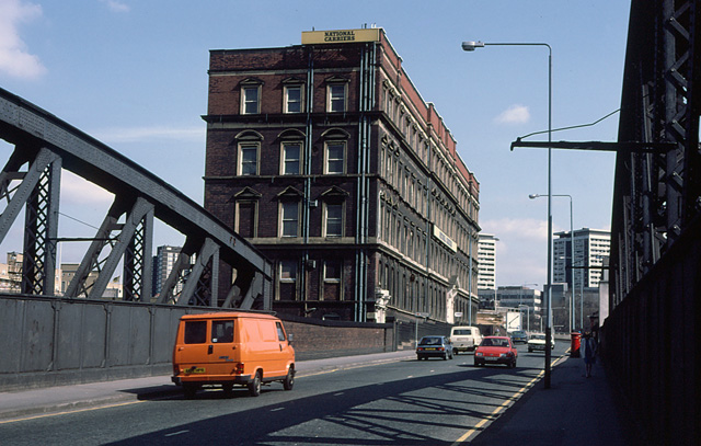
Image: © Martin Addison Taken: Unknown
View from the bridge carrying the road over the throat of Paddington Station. The National Carriers warehouse was sold off not long after this photo was taken and was available to let. It was subsequently demolished as Bishopsbridge road was widened and the area around the Paddington Basin was redeveloped. In the distance the road drops steeply down to a large roundabout on the Harrow Road, underneath the A40 Westway which is just visible behind the pillar box. The sign next to the metallic blue car indicates the entrance to Paddington station via the upper goods yard, normally used by cabbies.
Images are licensed for reuse under creativecommons.org/licenses/by-sa/2.0
Image Location
Latitude
51.518552
Longitude
-0.179358