Rillington Reading Room
Introduction
The photograph on this page of Rillington Reading Room by Leanmeanmo as part of the Geograph project.
The Geograph project started in 2005 with the aim of publishing, organising and preserving representative images for every square kilometre of Great Britain, Ireland and the Isle of Man.

There are currently over 7.5m images from over 14,400 individuals and you can help contribute to the project by visiting https://www.geograph.org.uk
Rillington Reading Room
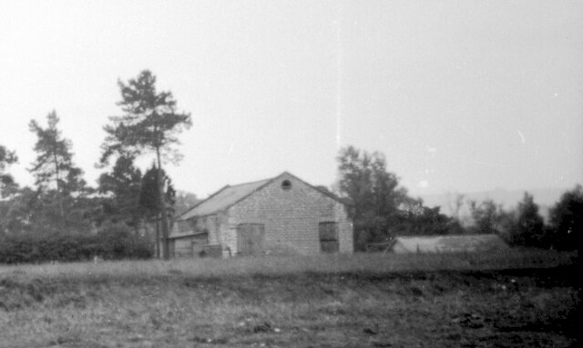
Image: © Leanmeanmo Taken: Unknown
Around 1947, taken from where the Woodlands Road houses would be built in 1948. It was demolished a year or two later. The remains of some of the walls just about survive, outside the cemetery, next to the road.
Images are licensed for reuse under creativecommons.org/licenses/by-sa/2.0
Image Location
Latitude
54.155792
Longitude
-0.692709