Bestwood Country Park- Mill Lakes area
Introduction
The photograph on this page of Bestwood Country Park- Mill Lakes area by Alan Murray-Rust as part of the Geograph project.
The Geograph project started in 2005 with the aim of publishing, organising and preserving representative images for every square kilometre of Great Britain, Ireland and the Isle of Man.

There are currently over 7.5m images from over 14,400 individuals and you can help contribute to the project by visiting https://www.geograph.org.uk
Bestwood Country Park- Mill Lakes area
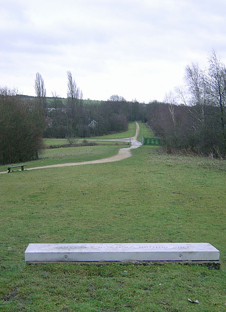
Image: © Alan Murray-Rust Taken: 13 Jan 2008
This is the alignment of the former Great Northern Railway Leen Valley branch. As well as being part of the Robin Hood Way at this point, it is also part of the Sustrans cycle network. The concrete slab in the foreground is a seat, and is inscribed "One million years of pressure", presumably with reference to the formation of the coal seams. This view is in the opposite direction to Image
Images are licensed for reuse under creativecommons.org/licenses/by-sa/2.0
Image Location
Latitude
53.02191
Longitude
-1.184786