Tram approaching Butlers Hill
Introduction
The photograph on this page of Tram approaching Butlers Hill by Alan Murray-Rust as part of the Geograph project.
The Geograph project started in 2005 with the aim of publishing, organising and preserving representative images for every square kilometre of Great Britain, Ireland and the Isle of Man.

There are currently over 7.5m images from over 14,400 individuals and you can help contribute to the project by visiting https://www.geograph.org.uk
Tram approaching Butlers Hill
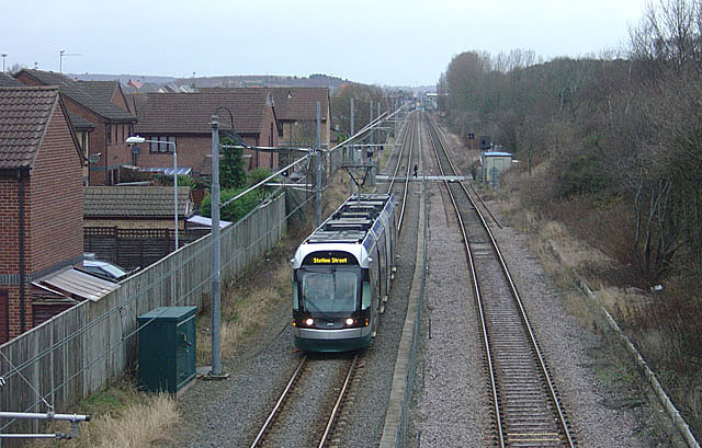
Image: © Alan Murray-Rust Taken: 13 Jan 2008
The right hand track is the Nottingham to Mansfield Railway, which was singled to provide space for the tram. The original intention was to have mixed tram and rail operation on the principle developed by Nottingham's twin city Karlsruhe, but it turned out to be impracticable to meet the requirements of the railway authorities.
Images are licensed for reuse under creativecommons.org/licenses/by-sa/2.0
Image Location


Leaflet Map data © OpenStreetMap
Latitude
53.030938
Longitude
-1.190431