OS Benchmark, Chevithorne
Introduction
The photograph on this page of OS Benchmark, Chevithorne by Meg Hepworth as part of the Geograph project.
The Geograph project started in 2005 with the aim of publishing, organising and preserving representative images for every square kilometre of Great Britain, Ireland and the Isle of Man.

There are currently over 7.5m images from over 14,400 individuals and you can help contribute to the project by visiting https://www.geograph.org.uk
OS Benchmark, Chevithorne
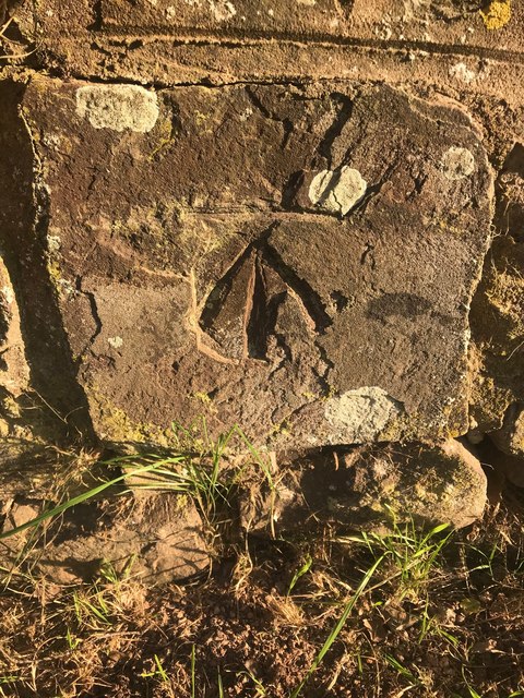
Image: © Meg Hepworth Taken: 14 Sep 2020
This is a cut benchmark, 0.5m above the ground and 129.80m above Ordnance Datum Newlyn (Tide Gauge Bolt Newlyn Pier - the authoritative datum for the UK). It was last verified in 1969. Grid ref: SS 9762 1544. Description: WALL SE SIDE RD 10.1M NE N ANG CHEVITHORNE FARM.
Images are licensed for reuse under creativecommons.org/licenses/by-sa/2.0
Image Location


Leaflet Map data © OpenStreetMap
Latitude
50.929296
Longitude
-3.458185