Cliff Road, Nottingham, NG1
Introduction
The photograph on this page of Cliff Road, Nottingham, NG1 by David Hallam-Jones as part of the Geograph project.
The Geograph project started in 2005 with the aim of publishing, organising and preserving representative images for every square kilometre of Great Britain, Ireland and the Isle of Man.

There are currently over 7.5m images from over 14,400 individuals and you can help contribute to the project by visiting https://www.geograph.org.uk
Cliff Road, Nottingham, NG1
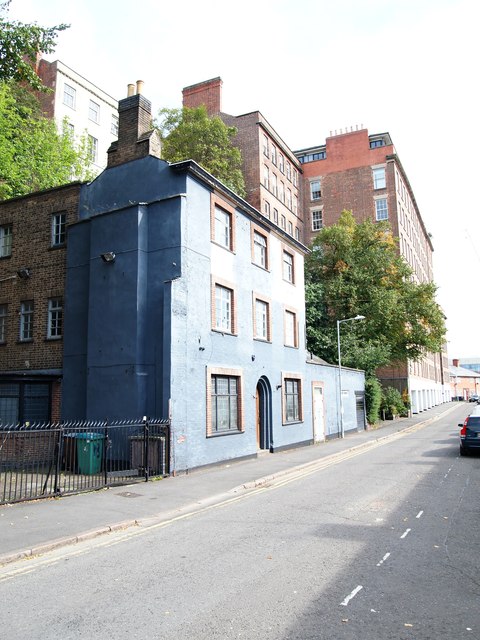
Image: © David Hallam-Jones Taken: 13 Sep 2020
Cliff Road, formerly Narrow Marsh, is situated at the foot of St. Mary's Cliff and as such is also within the Lace Market Conservation Area. The building in the centre of the picture is the former Loggerheads public house, an establishment that has not functioned as such for over 10 years. Planning permission is currently being sought for its conversion into nine apartments. St Mary’s Cliff is a distinctive landscape feature, sections of which have been reinforced with brick retaining walls to preserve properties on High Pavement above and behind it. On April 13th, 1828, a mass of rock and some brickwork, that had previously been part of a summer house, came cascading down crushing five houses adjoining the pub. One family who happened still to be in their home at the time of the accident escaped injury. In the distance former mill buildings associated with lace finishing processes were converted into apartments a number of years ago.
Images are licensed for reuse under creativecommons.org/licenses/by-sa/2.0
Image Location
Latitude
52.950336
Longitude
-1.143862