Tactile paving
Introduction
The photograph on this page of Tactile paving by Bob Harvey as part of the Geograph project.
The Geograph project started in 2005 with the aim of publishing, organising and preserving representative images for every square kilometre of Great Britain, Ireland and the Isle of Man.

There are currently over 7.5m images from over 14,400 individuals and you can help contribute to the project by visiting https://www.geograph.org.uk
Tactile paving
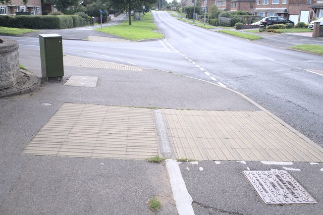
Image: © Bob Harvey Taken: 5 Sep 2020
The two directions of the ribs in the surface denote a footway and a cycleway in turn. The footpath along Belton Lane has been divided to provide off-road cycling.
Images are licensed for reuse under creativecommons.org/licenses/by-sa/2.0
Image Location
Latitude
52.923587
Longitude
-0.629866