The Street
Introduction
The photograph on this page of The Street by John Baker as part of the Geograph project.
The Geograph project started in 2005 with the aim of publishing, organising and preserving representative images for every square kilometre of Great Britain, Ireland and the Isle of Man.

There are currently over 7.5m images from over 14,400 individuals and you can help contribute to the project by visiting https://www.geograph.org.uk
The Street
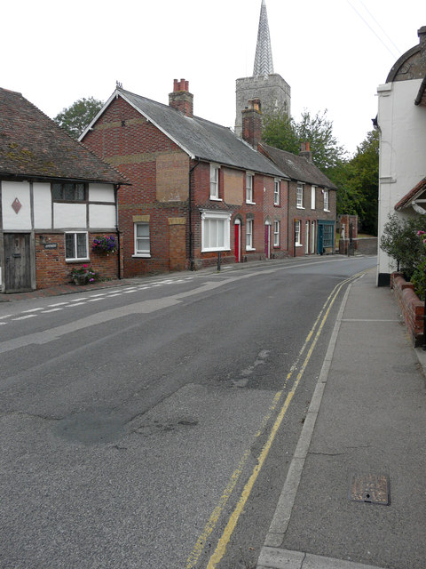
Image: © John Baker Taken: 14 Aug 2020
The view shows a ghost sign on the side wall of number 67 (whose post code is CT3 2 EN). The words on the sign are indecipherable but I was able to compare the address from an old street directory (published by Yellow Pages) with one on the same page, which showed that this was once Church Gates Bakery. Here is a description of the premises (although the name of the road is incorrect). Church Gates Bakery: this bakery on Ash High Street was owned for years by the Solly/Solley/Coleman family. It was then leased to Alexander Clark from 1922 to 1936. After that it was sold to a Mrs Hollaway https://www.curiousfox.com/vill100/Kent11296_1.html
Images are licensed for reuse under creativecommons.org/licenses/by-sa/2.0
Image Location
Latitude
51.278679
Longitude
1.279412