Direction Sign ? Signpost
Introduction
The photograph on this page of Direction Sign ? Signpost by W Marsh as part of the Geograph project.
The Geograph project started in 2005 with the aim of publishing, organising and preserving representative images for every square kilometre of Great Britain, Ireland and the Isle of Man.

There are currently over 7.5m images from over 14,400 individuals and you can help contribute to the project by visiting https://www.geograph.org.uk
Direction Sign ? Signpost
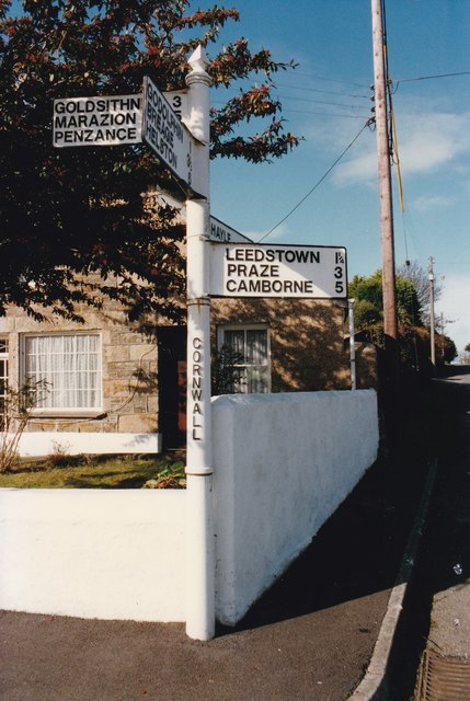
Image: © W Marsh Taken: Unknown
Located in Townshend on the northwest corner of the crossroads of the B3280 Bosence Road and Bunkers Hill in Crowan parish. 4 arms and pyramid spear finial. See also https://www.geograph.org.uk/photo/184046. By 2011 the Leedstown, Praze and Camborne arm had been broken off, see https://www.geograph.org.uk/photo/6099260. Milestone Society National ID: CW_SW5932
Images are licensed for reuse under creativecommons.org/licenses/by-sa/2.0
Image Location
Latitude
50.146707
Longitude
-5.371841