Antonine Wall
Introduction
The photograph on this page of Antonine Wall by Richard Sutcliffe as part of the Geograph project.
The Geograph project started in 2005 with the aim of publishing, organising and preserving representative images for every square kilometre of Great Britain, Ireland and the Isle of Man.

There are currently over 7.5m images from over 14,400 individuals and you can help contribute to the project by visiting https://www.geograph.org.uk
Antonine Wall
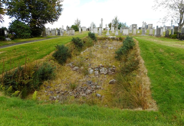
Image: © Richard Sutcliffe Taken: 6 Sep 2020
This is one of two short sections of the Antonine Wall visible within New Kilpatrick Cemetery. Both are Scheduled Monuments http://portal.historicenvironment.scot/designation/SM7341 and part of the Antonine Wall World Heritage Site https://www.historicenvironment.scot/advice-and-support/listing-scheduling-and-designations/world-heritage-sites/antonine-wall/. The remains of the stone base of the rampart are well preserved and show various distinctive features of construction. The cemetery, which was opened in 1903, has been built over the rest of the Wall at this point. The site is currently getting rather overgrown.
Images are licensed for reuse under creativecommons.org/licenses/by-sa/2.0
Image Location
Latitude
55.922498
Longitude
-4.311775