Ben Ledi Grit, Glen Lednock
Introduction
The photograph on this page of Ben Ledi Grit, Glen Lednock by Anne Burgess as part of the Geograph project.
The Geograph project started in 2005 with the aim of publishing, organising and preserving representative images for every square kilometre of Great Britain, Ireland and the Isle of Man.

There are currently over 7.5m images from over 14,400 individuals and you can help contribute to the project by visiting https://www.geograph.org.uk
Ben Ledi Grit, Glen Lednock
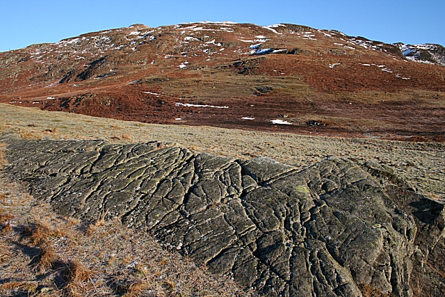
Image: © Anne Burgess Taken: 12 Jan 2008
The foreground is a tilted block of metamorphosed Ben Ledi Grit, its surface scored by erosion along cracks. Creag Liath in the distance is in the next square.
Images are licensed for reuse under creativecommons.org/licenses/by-sa/2.0
Image Location


Leaflet Map data © OpenStreetMap
Latitude
56.412991
Longitude
-4.031165