Direction Sign ? Signpost
Introduction
The photograph on this page of Direction Sign ? Signpost by W Marsh as part of the Geograph project.
The Geograph project started in 2005 with the aim of publishing, organising and preserving representative images for every square kilometre of Great Britain, Ireland and the Isle of Man.

There are currently over 7.5m images from over 14,400 individuals and you can help contribute to the project by visiting https://www.geograph.org.uk
Direction Sign ? Signpost
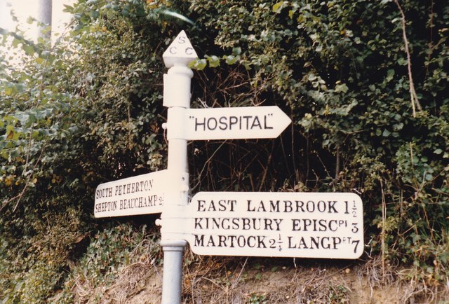
Image: © W Marsh Taken: Unknown
Located on the northwest side of the junction of Lightgate Road and Harvey's Road in South Petherton parish. 3 arms (now 4 arms) and pyramid finial. See 2009 photo https://www.geograph.org.uk/photo/6099091. See also http://www.flickr.com/photos/tollhouses/3886069961 and http://www.flickr.com/photos/13171205@N08/8371983216. Milestone Society National ID: SO_ST4316
Images are licensed for reuse under creativecommons.org/licenses/by-sa/2.0
Image Location
Latitude
50.948065
Longitude
-2.804894