Burstwick Drain in Hedon
Introduction
The photograph on this page of Burstwick Drain in Hedon by Andy Beecroft as part of the Geograph project.
The Geograph project started in 2005 with the aim of publishing, organising and preserving representative images for every square kilometre of Great Britain, Ireland and the Isle of Man.

There are currently over 7.5m images from over 14,400 individuals and you can help contribute to the project by visiting https://www.geograph.org.uk
Burstwick Drain in Hedon
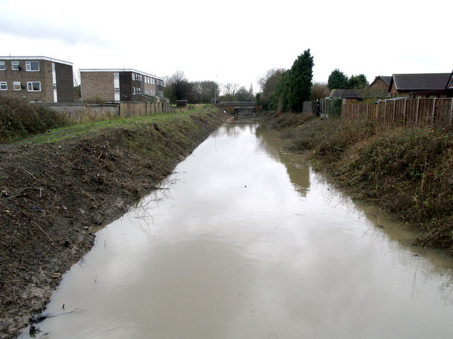
Image: © Andy Beecroft Taken: 15 Jan 2008
Burstwick Drain is the main land drainage channel in south west Holderness. Due to the disastrous floods of June 2007 in this flat area of East Yorkshire, efforts are now being made to clear the drain banks of unnecessary vegetation from the waterway to maximise its flow capacity during periods of heavy rainfall. Burstwick Drain flows into the River Humber near Saltend, 1.75 miles west of here, but can only do so at low tides when the river water level is low. To see what it looked like 20 months ago, follow link: Image
Images are licensed for reuse under creativecommons.org/licenses/by-sa/2.0
Image Location
Latitude
53.735702
Longitude
-0.196369