2008 : View from Kingsdown
Introduction
The photograph on this page of 2008 : View from Kingsdown by Maurice Pullin as part of the Geograph project.
The Geograph project started in 2005 with the aim of publishing, organising and preserving representative images for every square kilometre of Great Britain, Ireland and the Isle of Man.

There are currently over 7.5m images from over 14,400 individuals and you can help contribute to the project by visiting https://www.geograph.org.uk
2008 : View from Kingsdown
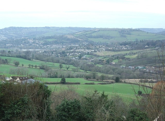
Image: © Maurice Pullin Taken: 12 Jan 2008
The By Brook, the A4 and the main line railway between Bath and Paddington are at the foot of the valley before us and to the right. Little Solsbury Hill Image stands in the top right hand third of the frame with the top of Lansdown running almost the whole width behind it. If you look carefully you can see Beckford's Tower. Image Batheaston is this side of Little Solsbury. This makes an interesting comparison with Image] which was taken from a spot near Brown's Folly.
Images are licensed for reuse under creativecommons.org/licenses/by-sa/2.0
Image Location


Leaflet Map data © OpenStreetMap
Latitude
51.402698
Longitude
-2.274093