Sedimentary rocks at the Bendricks
Introduction
The photograph on this page of Sedimentary rocks at the Bendricks by Alan Hughes as part of the Geograph project.
The Geograph project started in 2005 with the aim of publishing, organising and preserving representative images for every square kilometre of Great Britain, Ireland and the Isle of Man.

There are currently over 7.5m images from over 14,400 individuals and you can help contribute to the project by visiting https://www.geograph.org.uk
Sedimentary rocks at the Bendricks
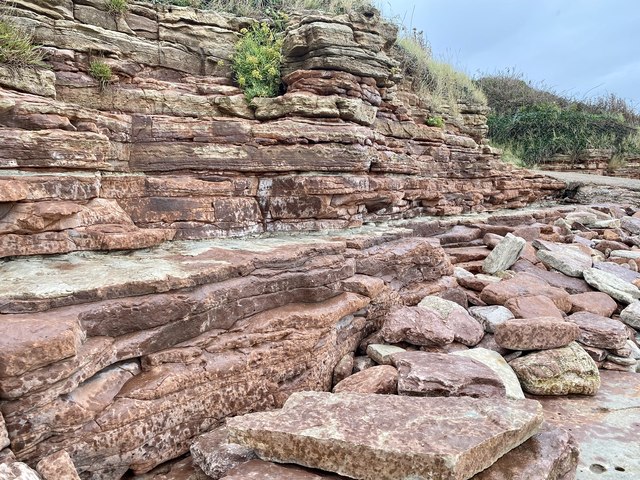
Image: © Alan Hughes Taken: 2 Sep 2020
“ During the Late Triassic it is probable that the Bendrick Rock area was a low lying marginal environment, where large ephemeral fluvial (river and stream) systems sporadically filled a larger, heavily evaporated, hypersaline lake. The fluvial deposits are interpreted as the result of periodic flash flood events and show a range of sediments and depositional structures. The rivers that existed in this area would have periodically filled the lakes and during times of heavy rainfall burst their banks creating extensive shallow floodplains. These flood events would have deposited fine muds over a wide area and left many shallow pools of rapidly evaporating water.“ [The Geological Society]
Images are licensed for reuse under creativecommons.org/licenses/by-sa/2.0
Image Location
Latitude
51.396749
Longitude
-3.246316