St Mary's Way, Dumbarton
Introduction
The photograph on this page of St Mary's Way, Dumbarton by Lairich Rig as part of the Geograph project.
The Geograph project started in 2005 with the aim of publishing, organising and preserving representative images for every square kilometre of Great Britain, Ireland and the Isle of Man.

There are currently over 7.5m images from over 14,400 individuals and you can help contribute to the project by visiting https://www.geograph.org.uk
St Mary's Way, Dumbarton
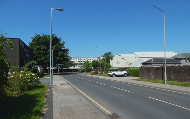
Image: © Lairich Rig Taken: 1 Jun 2020
The name presumably refers to the long-gone St Mary's Collegiate Church, of which the most conspicuous relic is Image Despite the area's changing beyond recognition in the meantime, there is a certain continuity in that there was a St Mary's Way hereabouts even before the first OS maps of the area were made in c.1860; see the description for Image The church described there as opening in 1843 was located on St Mary's Way; it stood at Image, about 80 metres WSW of the point from which this picture was taken. A memorial that originally stood just outside the front (the SSW side) of that church does survive, but in a quite different location inside (and not far from the main entrance of) Dumbarton Cemetery: Image Returning to what can be seen in the picture: the Denny Civic Theatre is the large dark building on the left. Across the road from it is a bowling green (Dumbarton Bowling Club). A large building, seen from the rear in the right background, is what was once a cinema, and then (until recently, when it succumbed to the pressures of the virus-related lockdown affecting the country), a bingo hall. Further away, just left of centre, are the Risk Street flats, which had recently been renovated: Image
Images are licensed for reuse under creativecommons.org/licenses/by-sa/2.0
Image Location
Latitude
55.944439
Longitude
-4.569657