Old Boundary Marker
Introduction
The photograph on this page of Old Boundary Marker by Mike Rayner as part of the Geograph project.
The Geograph project started in 2005 with the aim of publishing, organising and preserving representative images for every square kilometre of Great Britain, Ireland and the Isle of Man.

There are currently over 7.5m images from over 14,400 individuals and you can help contribute to the project by visiting https://www.geograph.org.uk
Old Boundary Marker
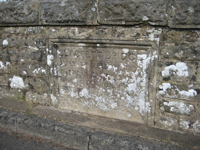
Image: © Mike Rayner Taken: 31 Aug 2020
Bridge Marker set in the northeast bridge parapet of Blackett Bridge, River West Allen. Plenmeller with Whitfield parish. Inscribed BLACKETT BRIDGE / BUILT BY SUBSCRIPTION / THE FOUNDATION STONE / WAS LAID BY EDWARD BLACKETT ORD / APRIL XV.MDCCCLVII (15 April 1855). Grade II Listed details https://historicengland.org.uk/listing/the-list/list-entry/1045440. Milestone Society National ID: NB_PLEWHI01br
Images are licensed for reuse under creativecommons.org/licenses/by-sa/2.0
Image Location
Latitude
54.880861
Longitude
-2.344204