Rough land and arable field west of Deadridge Lane
Introduction
The photograph on this page of Rough land and arable field west of Deadridge Lane by Andrew Curtis as part of the Geograph project.
The Geograph project started in 2005 with the aim of publishing, organising and preserving representative images for every square kilometre of Great Britain, Ireland and the Isle of Man.

There are currently over 7.5m images from over 14,400 individuals and you can help contribute to the project by visiting https://www.geograph.org.uk
Rough land and arable field west of Deadridge Lane
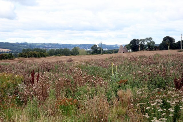
Image: © Andrew Curtis Taken: 30 Aug 2020
Once an area of clay pits serving Corbridge Pottery. The remaining kilns of which can be seen in the distance. There were also the quarries and buildings of Corbridge Brick Works which is now a housing estate. The latter was the site of Jameson & Sons Pipe Works, which was once one of the biggest employers in Tynedale and closed in the 1980s. One of the Jameson bricks is shown here: Image
Images are licensed for reuse under creativecommons.org/licenses/by-sa/2.0
Image Location
Latitude
54.981582
Longitude
-2.007938