Tarporley Milestone
Introduction
The photograph on this page of Tarporley Milestone by Brian Deegan as part of the Geograph project.
The Geograph project started in 2005 with the aim of publishing, organising and preserving representative images for every square kilometre of Great Britain, Ireland and the Isle of Man.

There are currently over 7.5m images from over 14,400 individuals and you can help contribute to the project by visiting https://www.geograph.org.uk
Tarporley Milestone
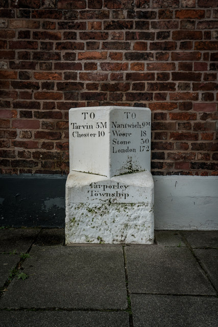
Image: © Brian Deegan Taken: 22 Aug 2020
TARPORLEY C.P. HIGH STREET Mile Stone II GV Milestone. C19. Ashlar. Rectangular base dying via broaches to an angled stone inscribed Tarporley Township on the base and at left and right on angled stone. TO / Tarvin 5M / Chester 10 TO / Nantwich 9M / Woore 18 / STONE 30 / LONDON 172 https://historicengland.org.uk/listing/the-list/list-entry/1136670 Milestone Society National ID: CH_CHNW10. https://www.milestonesociety.co.uk/
Images are licensed for reuse under creativecommons.org/licenses/by-sa/2.0
Image Location
Latitude
53.159005
Longitude
-2.668918