The Old School House
Introduction
The photograph on this page of The Old School House by Ian Capper as part of the Geograph project.
The Geograph project started in 2005 with the aim of publishing, organising and preserving representative images for every square kilometre of Great Britain, Ireland and the Isle of Man.

There are currently over 7.5m images from over 14,400 individuals and you can help contribute to the project by visiting https://www.geograph.org.uk
The Old School House
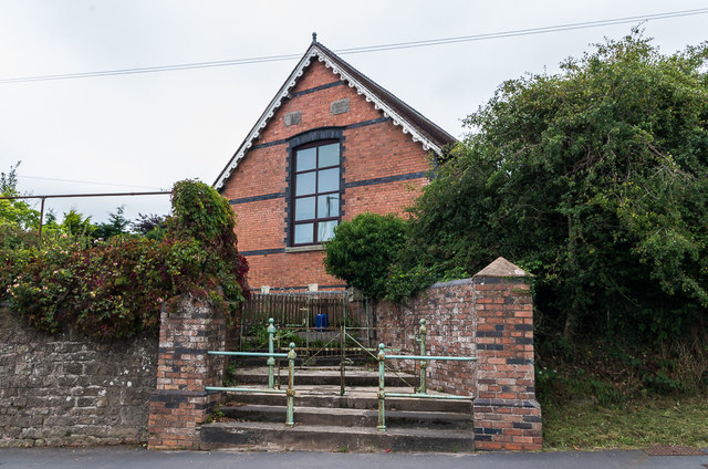
Image: © Ian Capper Taken: 6 Aug 2020
Former school, now converted to residential use. The plaques on the gable read "Wesleyan Day and Sunday Schools" and "Erected Anno Domino 1878".
Images are licensed for reuse under creativecommons.org/licenses/by-sa/2.0
Image Location
Latitude
52.375077
Longitude
-2.60411