Reculver Country Park above Bishopstone Cliffs
Introduction
The photograph on this page of Reculver Country Park above Bishopstone Cliffs by Marathon as part of the Geograph project.
The Geograph project started in 2005 with the aim of publishing, organising and preserving representative images for every square kilometre of Great Britain, Ireland and the Isle of Man.

There are currently over 7.5m images from over 14,400 individuals and you can help contribute to the project by visiting https://www.geograph.org.uk
Reculver Country Park above Bishopstone Cliffs
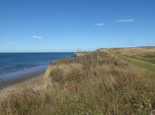
Image: © Marathon Taken: 20 Aug 2020
This is the Thanet Coastal Path as it heads to Reculver. The same route is followed by the Saxon Shore Way. The remains of St Mary's Church can be seen in the distance. The towers of the ruined church are a landmark for miles around. For a close up of the church see https://www.geograph.org.uk/photo/6579754
Images are licensed for reuse under creativecommons.org/licenses/by-sa/2.0
Image Location


Leaflet Map data © OpenStreetMap
Latitude
51.377547
Longitude
1.191044